
Compare Grant County Property Values by Type
Grant County assessor records hold several figures labeled as value. Appraised, assessed, and cost amounts sit alongside sale data. The appraised figure is the Assessor's own estimate. Assessed value serves as the base for the tax calculation, while a sale price or consideration belongs to one specific transaction. No single number guarantees what a property would fetch on the market today.
| Value | What It Is | Where |
|---|---|---|
| Appraised value | Assessor's full-value estimate for the parcel | WV Property Assessment / Viewer |
| Assessed value | Tax calculation base at 60 percent of appraisal | Assessor roll |
| Sale price or consideration | Amount recorded or reported for a transaction | Deed and assessment sale fields |
| Land / building cost values | Separate assessor categories | Property Viewer detail |
West Virginia uses a simple formula. Appraised value multiplied by 60 percent yields the assessed amount, which is then multiplied by the levy rate to produce the tax. A purchase price marks one event on a date. An assessment is part of a recurring roll. The Grant County property tax record explains the bill and appeal process, while this comparison sticks to what the numbers themselves mean.
Grant County Appraisal Fields Update Annually
The state assessment search offers four modes. The modes are Basic, Appraisal/Sales, Advanced, and Prior Ownership. Filters cover land, building, and total appraisal, sale dates and price, calculated and deeded acreage, class, land use, building year, and structure details. The Viewer detail panel labels cost values and appraised values separately. One parcel can display several numbers. Read each field label together with its tax year before drawing a conclusion.
Grant County's Assessor runs sales-ratio analysis every year. Land values get an annual update as well. Statewide data refreshes once the new assessment information arrives, so a value field can lag behind a recent sale or improvement. No neighborhood appreciation series exists. Tie every comparison to the roll year shown rather than treating it as a current sale estimate.
The assessment search shows the appraisal and sale filters.
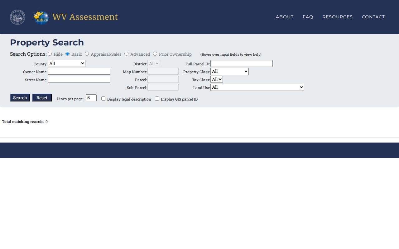
Use its filter labels to distinguish a sale entry from an appraisal amount.
Grant County Value Uses a July Assessment Date
West Virginia sets ownership, use, and value as of July 1 for the next calendar tax year. The county completes assessment books by January 30 and submits them to the Board of Review and Equalization by February 1. Grant County's Commission sits as that board. The cycle helps explain why the value on a bill is tied to a tax year rather than to the day a person opens the Viewer.
Class II covers owner-occupied residential property and owner-occupied farms. Class III applies to property outside a municipality and outside Class I or II; Class IV is the corresponding property within a municipality. The class affects levy context. Compare class with the parcel's municipal location before comparing assessed totals across properties.
The state formula is appraised value multiplied by 60 percent, then assessed value multiplied by the levy rate. The assessment number and the tax bill are not interchangeable.
Grant County Sale Price Is a Separate Record
The assessment search carries sale date and price fields. A recorded deed can list consideration among its instrument data. Neither is a promise of current market value. A deed's amount may ignore later changes, financing terms, or the parcel's condition today, even though it documents the legal transfer. Treat each as a transaction reference.
Match the book, page, parcel ID, and land description before comparing a sale with an assessment. The deed holds the details that matter. Grantor, grantee, recording date, acreage, and any reservations all deserve a read. Multi-parcel transfers make single prices hard to assign. For the transfer itself, turn to Grant County deed records, which cover the recorded instrument and its context.
Look Up a Grant County Value Field
Start with the statewide assessment search and choose Grant County. Search by address, owner, or parcel. Open the matching result in the Viewer. The detail panel lists cost values and appraised values. The search side adds appraisal ranges, sale dates, sale-price ranges, and land and building filters. Keep the parcel ID with every number. That way a neighboring parcel never slips into the comparison.
- Select Grant County and search the address, owner, or full parcel ID.
- Open the Property Viewer and note the appraised and cost-value labels.
- Check the assessment search's sale fields and record the displayed date and amount.
- Use the deed's stated consideration as transaction context, not a current appraisal.
- Assessed value
- The tax base, calculated in West Virginia at 60 percent of appraisal.
- Appraised value
- The Assessor's value estimate for the parcel.
- Sale consideration
- The amount stated or reported for a specific transfer.
- Reassessment cycle
- The annual process that updates the roll and land values.
Grant County Taxable Value Can Differ by Class
Grant County's Homestead program lowers the taxable assessed amount for an eligible owner-occupied property. The local FAQ calls the first $20,000 of assessed value the exemption amount. Ask the Assessor about current eligibility and application rules. Remember that the appraised value and the taxable figure answer different questions. Keep them distinct. A value comparison should never mix the two.
Published 2022 levy estimates show why a city total is only a fiscal snapshot. Petersburg listed $38,209,020 in Class II real-estate assessed value. Its Class IV figure was $25,008,470. Bayard listed $1,865,880 for Class II. Class IV there came to $693,560. These are 2022 totals, not neighborhood appreciation or today's sale prices. The county publishes no city-specific revaluation series.
Check class and tax year before comparing totals. Class III covers property outside a municipality that is not Class I or II. Class IV is the matching category inside a municipality. A countywide or townwide roll total blends many parcels, so it cannot stand in for a parcel-level appraisal. A sound comparison keeps municipality, tax year, class, exemption status, and levy context visible instead of treating a bigger aggregate as proof that one home gained value.
The Commission's Board of Review and Equalization starts its annual review on February 1, after the assessment books close. Does a value look wrong? Compare the parcel record and tax year first. Then ask the Assessor or Commission for the current review process, and confirm the appeal form and filing deadlines with those offices rather than inferring them from the calendar. The Grant County Tax FAQ describes Homestead and current tax procedures.
Note: Treat the Viewer values as the assessor's record for that roll, not as a current market appraisal.
Grant County GIS Acres Do Not Set Value
The Viewer can display parcel geometry and calculated acreage. That acreage comes from map measurement. Deeded acreage is the conveyance figure. It has priority under West Virginia's tax-map rule when the two differ. The Grant County ArcGIS service describes itself as a tool for assessment and planning. It is not an authoritative legal boundary or survey. A map area never sets value or fixes a boundary.
Suppose an acreage difference affects a valuation question. Compare the deed's legal description, the Assessor's deeded-acre field, and the map. Set any survey or plat beside them. State data can update annually while parcel geometry lags longer. A mismatch is a reason to ask the Assessor for the record source. It is never a reason to substitute a polygon's calculated area for the conveyance.
What a Grant County Assessment Does Not Say
A Grant County assessment exists for property-tax work. It is not a promised sale price. It is not a licensed appraisal for a transaction either. The figure can differ from what a buyer and seller agree on. A new sale may occur between annual updates. A last-sale field is historical too. So it cannot guarantee the same conditions, improvements, or market when a later decision is made.
Value vs price. Grant County assessed value is a tax figure, not an offer or market guarantee. Use a qualified appraiser for a current valuation decision.