
Move from a Grant County Address to Its Parcel
The West Virginia assessment search offers several modes. You can choose Basic, Appraisal/Sales, Advanced, or Prior Ownership. Pick Grant County. For a house or tract, start with Street Name or Owner Name. When a result appears, write down the displayed owner, physical address, and parcel ID. Add the legal description, deed book and page, and any sale fields. The state search can also link your result to the Property Viewer for a map and a detail panel.
Remember that this route is a property search, not a title conclusion. The county Clerk's Document IDX link publishes no verified public form. So do not assume every deed image or index field is online. If the assessment search misses the address, try a name or a district/map/parcel key instead. Mapping and Addressing can say whether an E-911 name or number changed.
The West Virginia Property Assessment landing page links county selection and search modes.
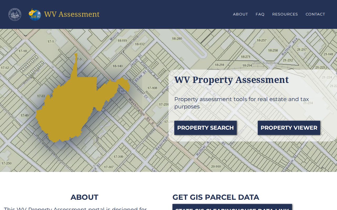
Select Grant County before typing a road, owner, or parcel detail. That keeps the results tied to the right county.
- Search Grant County by E-911 street address, street name, owner, or full parcel ID.
- Open a likely result and note the GIS or IAS identifier and deed book/page.
- Compare the situs address with the mailing address, since tax notices can go elsewhere.
- Check the latest deed with the County Clerk and the tax ticket with the Sheriff.
- Use the map to orient the parcel, not to settle a boundary.
Grant County Property Search Field Guide
Most search controls are optional, so one known detail can be enough to start. The state tool separates ordinary owner and street lookups from Appraisal/Sales and Advanced filters. Choose Grant County first. Then narrow with district or a parcel segment if the result set is broad. A name can belong to an individual, an estate, or a company. Spelling differences may split the results.
| Field | Format or role | Search use |
|---|---|---|
| Owner Name | Text | Search parcels attached to a name |
| Street Name | Text | Find a road segment or block |
| Full Parcel ID | Text | Match a complete assessment key |
| District, Map, Parcel, Sub-Parcel | Separate selectors or text fields | Rebuild a known tax-map reference |
| Mailing Address | Text | Find where notices are sent |
| Deed Book / Page | Text fields | Follow a Clerk reference |
| Sale dates / price | Date and numeric ranges | Narrow sales entries |
| Legal description / Flood Hazard | Text and dropdown | Refine a tract or hazard result |
The form also exposes property class, tax class, land use, appraisal ranges, calculated and deeded acres, construction year, structure counts, building area, and result pagination. "Display legal description" and "Display GIS parcel ID" add those values to the results. They help separate nearby parcels. Still, the legal description and deed control any title question.
Open the state assessment search to compare its field labels with the clue on hand.
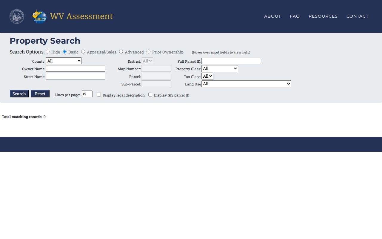
A narrow Grant County query is far easier to verify.
Use the Grant County Road Index Carefully
The 2019 road-name index bridges an address and the county's district/map scheme. It records official names, address ranges, municipality labels, and map references. Petersburg entries include Pierpont Street, Pine Street, Point Drive, Port Republic Avenue, and Potomac Avenue. Bayard entries include Pine Street, Potomac Avenue, and Vine Street. Keep the municipality with the road name, because Pine and Potomac appear in both places.
An address is a locator, not a parcel description. A mailing city can cover an unincorporated property. A road can carry a route label. A parcel can even have a mailing address different from its physical location. If the current road name fails, try a shortened name or the owner. The district/map clue from the road index offers one more fallback. Mapping and Addressing is the county office for E-911 assignments and official road-name questions.
The road index shines in one common case. A Grant County property search may return more than one plausible place. Confirm the matching parcel against the deed's legal description.
Fields on a Grant County Parcel Result
A Property Viewer result row can show a GIS ID, owner name or names, and physical address. Open the detail panel for building information and cost values. You will also find appraised values, flood information, external map links, and an assessment report. The assessment search may also expose deed book and page. It can show parcel ID, legal description, sale fields, and mailing address. Treat any result as an index into these records. It is not a full deed image or a certified history.
| Property Owner | Owner name displayed by the state Viewer |
|---|---|
| Physical / Mailing Address | Parcel location and separate notice address |
| GIS ID / Parcel ID | Map key that links search and display |
| Costs / Appraised Values | Assessor categories and value fields |
| Deed Book / Page | Reference to confirm with the Clerk |
| Flood / Assessment Report | Map context and linked assessment detail |
The Viewer shows only one owner at times, even when a parcel has multiple owners. The mailing address can differ from the physical address. A recent deed may not yet flow into the annual state data. For the current paper transfer, compare the latest recorded deed. For a legal line, use a survey. A broad Grant County property search should end with the exact parcel. It should not stop at just a familiar street name.
The West Virginia Property Viewer shows the owner, address, values, flood details, and assessment-report link.
Use the parcel detail to collect a key for follow-up. Then verify ownership in the deed record.
Grant County Property Search Also Uses Tax Tickets
The Sheriff Tax Office uses its own keys. A taxpayer name, account, ticket, or map/parcel starts the query. Filters narrow the field by tax year. Others separate real from personal property, or paid from unpaid status. Names go in the box marked "last first." Account numbers run up to ten characters. Ticket and suffix sit in separate fields. A district choice then loads the map, parcel, and subparcel selectors. The five districts are Bayard, Grant, Milroy, Petersburg, and Union.
A ticket or account number is the direct route once a tax bill is in hand. The form shows no preview of its result layout. Ask the Sheriff what a taxpayer query returns. Online payment is linked, but a processor fee applies. Use the Grant County Sheriff Tax Search for ticket and account lookups.
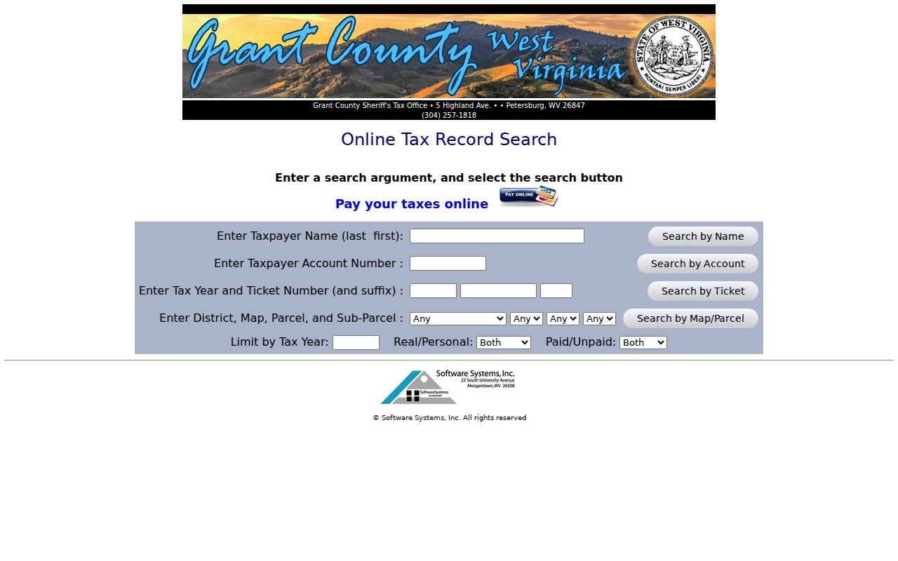
A Sheriff tax record settles a tax-status question only. It does not prove that the name on the ticket holds title to the property.
Grant County Property Search Data Can Lag
Statewide assessment data refreshes once a year. New tax figures arrive with that annual update. The state itself warns that a fresh owner change may not have reached the Viewer yet. Grant County's Sheriff FAQ explains another wrinkle. A tax bill can keep listing the former owner until the deed is filed and a copy reaches the Assessor. No fixed day-count exists for that lag. Compare the roll date with the recording date instead of trusting a guessed interval.
New parcel lines travel a separate path. For transfers running July 1 through June 30, revised maps are due to the State by February 1 of the next calendar year. State guidance says to take lines still unupdated after two years back to the local Assessor. Bring the deed copy, the full parcel key, and the relevant tax year when asking for a review.
That timing is why an owner search can disagree with a tax bill or Viewer result. The newest recorded deed is the better check. It shows whether a transfer was completed.
Pine Street Can Split a Grant County Search
Pine Street appears in the county road index twice, once for Petersburg and once for Bayard. Petersburg's street ranges tie to district 21. Its map patterns run 21, 21C, 21CC, and 21CD. For Bayard, the entries instead use map references 2 and 2CB. Those references are clues rather than a full parcel ID, but they explain why a street-only query returns a puzzling mix.
Carry the town label, road range, tax district, and full parcel number between the assessment, tax, and GIS tools. Petersburg's 26847 and Bayard's 26707 are mailing ZIPs. They are not proof of a corporate boundary. With only a route or PO box in hand, search by owner or road name. Mapping and Addressing can then resolve the E-911 locator.
Choose a Grant County Search Key
The best search key depends on what is already known. Address search is fast but vulnerable to street-name overlap. Owner search can pull back far too many parcels. A complete map/parcel key is precise when copied correctly. The Sheriff tax form adds a ticket or account option, which is handy whenever a mailed bill sits on the desk.
Rural addresses and PO boxes pose a different problem. The state Viewer may not match them, because its physical-address search leans on E-911/SAMS data. Try the road name or the owner instead. A split property can carry several tax map records and more than one deed. Save the result IDs before switching systems, since the state GIS, the assessment system, and the local tax form rarely format identifiers the same way.
The three routes make useful starting points. None of them proves title or replaces a survey.
| Search Key | Best For | Where It Works | Watch Out |
|---|---|---|---|
| Address or street | Locate a known site or build a block list | Assessment search and Viewer | Same name may cover Bayard and Petersburg |
| Owner name | Find parcels indexed to a person or entity | State assessment search | Annual roll may lag a deed |
| District / map / parcel | Match a tax-map tract or ticket | Assessor, Viewer, Sheriff | Keep all segments and suffixes |
An empty result usually means the key is wrong. The county record itself may still exist. An E-911 physical address often differs from a mailing address, so try both forms. A road index can expose the official road name. The map range appears there too. Map/parcel keys must keep district and suffix. The statewide GIS identifier is built from separate parts, and the Viewer, the assessment account, and the Sheriff ticket share no single number.
Older transfers point to the Archives finding aid. It lists deed volumes from 1865 through 1908 and deed indexes from 1866 through 1969. Those are microfilm dates only, not a confirmed cutoff for the County Clerk's current web index. The county-linked IDX address offers no usable form, so ask the Clerk to search the books or its public terminal when an online lookup stops short. The state assessment search modes and fields show the available county search routes.
Pick the search mode that matches the record clue. Then carry the full result key into the next office's lookup.
Not a title search. A Grant County property search gathers assessment, tax, and map clues. Confirm the present transfer in the Clerk's deed record, and use a title professional or licensed surveyor for title or boundary conclusions.